Sampling process
Sampling process
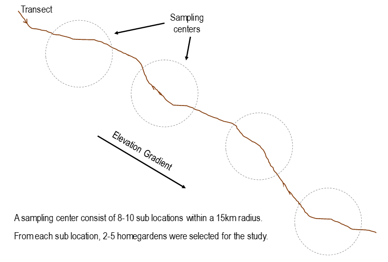
Within each district, a transect was identified along an elevation gradient, which ran through villages, towns and small cities dwelling from urban, sub-urban and rural areas of the respective administrative unit. An effort was taken to capture almost all the AER in the districts in laying the transect across the district to make sure the sampling process identified the diversity exists among homegardens in each district. Thus, along the transect 4-5 different locations were identified giving consideration to the ecological and environmental variations observed owing to the diversity among different climatic zones and AERs. These locations were noted as villages or cities, for the convenience of recording. Basically, a district comprised of 4-5 selected villages or cities sampling centers. Within each sampling centers, 8-10 sub-locations were recorded to facilitate selection of individual homegarden for the study. These sub-locations represented dwelling from urban, sub-urban and rural areas and were scattered approximately within 15 km radius of the identified sampling centers, along the transect. From each sub-location, 2-5 homegardens were selected for the study by employing Latin Hypercube sampling which enables the capturing the maximum diversity of homegardens within each center of location and transect while keeping the selection as random as possible. Accordingly, approximately 150 homegardens were included for the survey, within a district.